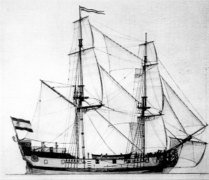
 Built in 1767 at the Naval Department of San Blas, Mexico, the San Carlos served as a supply ship, operating between San Blas and Alta California. This sketch is based on the known dimensions of the little ship. Drawing by Raymond Aker, 1975.
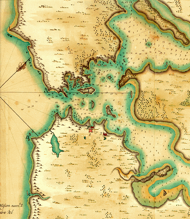
In August 1775, Lt. Juan Manuel de Ayala brought his ship, the San Carlos, into San Francisco Bay, and anchored in what is now Ayala Cove. His mission was to develop an accurate description of the bay that future Spanish ship captains could rely on. Ayala’s pilot, Don Jose’ de Canizares, explored the bay in the ship’s launch, and did the necessary map work – the first map ever made of the magnificent and now world-famous harbor. The San Carlos remained at anchor beside the little island that Ayala christened Isla de Los Angeles (Spanish for Island of the Angels), following a practice then common among Catholic explorers of naming sites for the religious feast days nearest to the time of discovery.
In the early years of the nineteenth century, the island was probably uninhabited. The Indians had all been drawn into Mission San Francisco de Asis (Mission Dolores in San Francisco), or driven out of the region. After 1808, though, Russian sea otter hunting expeditions visited the island, establishing a storehouse there. In 1814, the British 26-gun sloop-of-war, the H.M.S. Racoon, was damaged off the coast of Oregon, but managed to stay afloat long enough to reach San Francisco Bay. From March 13 to 19 of that year, the ship was repaired on the beach at Ayala Cove. Today, the deep-water channel between Tiburon and Angel Island is named Racoon Strait, in honor of the old British sailing ship.
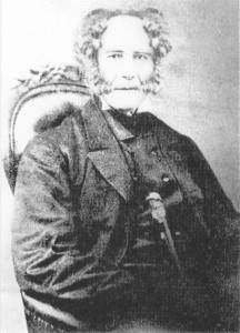
In 1837, Antonio Maria Osio asked the governor of California to give Angel Island to him for use as a cattle ranch. In his capacity as military commandant of Alta California, General Vallejo endorsed the petition with the provision that some of the island be retained for harbor defense. Osio’s grant was approved by the governor in 1839, and thereafter he kept cattle – up to 500 of them – on the island. He had several houses built for use by his herders and other attendants, although he himself never lived on the island. After 1846 and the war between Mexico and the United States, Osio’s title was disputed by various people, and a number of squatters took up residence on the island.
 Plano del Puerto de San Francisco. This is the chart of San Francisco Bay drawn by Jose de Canizares in August 1775, while the San Carlos was anchored at Angel Island. It was the first adequate map of San Francisco Bay. Courtesy of California State Parks.

Antonio Maria Osio. This is the only kown photograph of Osio. When he died in Baja California he had attained the age of 78, a very advanced age at the time. He outlived at least nine of his seventeen children. Circa 1850
Our Community. Our Island. Our Legacy.
Angel Island Conservancy// PO Box 866 / Tiburon / CA 94920// info@angelisland.org// Tax ID No. 51-0152954// FACEBOOK// FLICKR// INSTAGRAM